10-Minute Museum: Climate Crisis Mathematics
This is a travelling museum you can visit in only 10 minutes. You learn how mathematical models help us understand global warming and predict changes in the climate.
Earth grid models
Programm
Licenses
Documentation
Autoren
Contributors: Hilary Weller, Christian Kuehnlein (Source data) and Oliver Labs (3D printing data)
Mitwirkende
Zugehörige Events
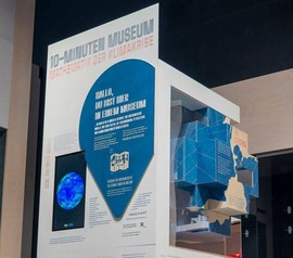
10-Minute Museum: Climate Crisis Mathematics
This is a travelling museum you can visit in only 10 minutes. You learn how mathematical models help us understand global warming and predict changes in the climate.
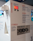
On the initiative of the Cluster of Excellence Mathematics Münster, IMAGINARY’s 10-Minute Museum complements the special exhibition “The Climate” at the LWL Museum.
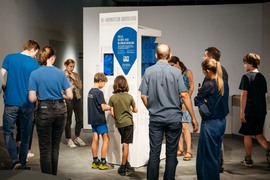
 Photo by Werkstatt für alles
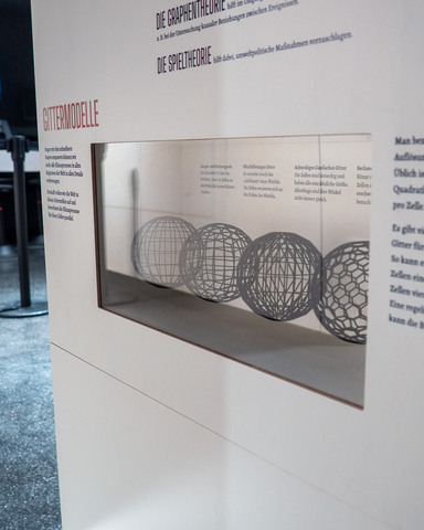
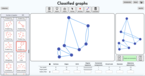
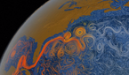
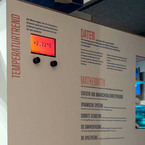
Even with the fastest supercomputers, we cannot fully model all climate processes in all regions of the world. Therefore, we divide the world into small grid cells and calculate the climate processes for these cells in parallel. The size of the cells is called the resolution of the grid. A common resolution is 100 square kilometers of Earth’s surface per cell.
There are many criteria for picking a grid for our models. Sometimes it’s advantageous if all cells are of similar size or if the cells are quadrilateral. A regular arrangement of the cells can simplify the calculation.
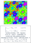
Examples of grid models:
- Latitude and Longitude Grid: The classic! It has the problem that the cells become smaller towards the poles.
- Cubed Sphere grid: It is created by “inflating” a cube. Its cells get distorted where the cube’s edges meet.
- Hexagonal Icosahedral grid: Can you find the cells with five sides? These make it difficult to list adjacent cells.
- Octahedral Gaussian grid: Cells are triangles of similar sizes. Their angles, however, are not always the same.